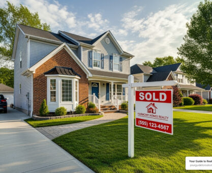
Why Drone Real Estate Photography Is Changing Property Marketing
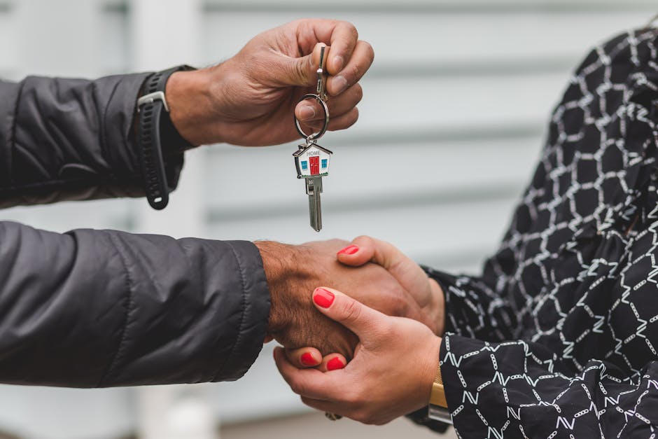
Drone real estate photography has revolutionized how properties are marketed and sold, offering stunning aerial perspectives that ground-level photos simply cannot capture. This technology uses unmanned aerial vehicles equipped with high-resolution cameras to showcase properties from above, providing buyers with a complete view of homes and their surroundings.
What is drone real estate photography?
- Aerial photography and videography captured using unmanned drones
- Shows property layout, landscaping, and neighborhood context from above
- Requires FAA Part 107 certification for commercial use
- Typically costs $150-$500+ depending on property size and services
Key benefits for sellers and agents:
- 68% faster sales compared to listings without aerial photos
- 65% more likely to generate in-person showings
- 83% of home sellers prefer agents who use drone photography
- Better showcasing of large properties, pools, and outdoor amenities
The real estate industry has witnessed a dramatic shift in buyer expectations. With 97% of home buyers starting their property search online, visual content has become the make-or-break factor in capturing attention. Traditional ground-level photos often fail to tell the complete story of a property – they can’t show the sprawling backyard, the proximity to parks, or how the home sits on its lot.
Modern buyers, particularly tech-savvy Millennials who make up nearly half of recent home purchases, expect rich, engaging visuals that help them envision their future lifestyle. Seven in ten agents report that drone photography has become more important since the COVID-19 pandemic, as virtual property exploration became essential.
This comprehensive guide will walk you through everything you need to know about drone real estate photography – from legal requirements and equipment selection to pricing strategies and marketing techniques that can transform your property listings.

Drone real estate photography word guide:
Why Aerial Views Are a Game-Changer in Real Estate
Picture this: you’re scrolling through property listings online, and suddenly you see a stunning aerial shot that shows not just the house, but the entire story of the property. That’s the magic of drone real estate photography – it transforms how we showcase homes by revealing the complete picture that ground-level photos simply can’t capture.
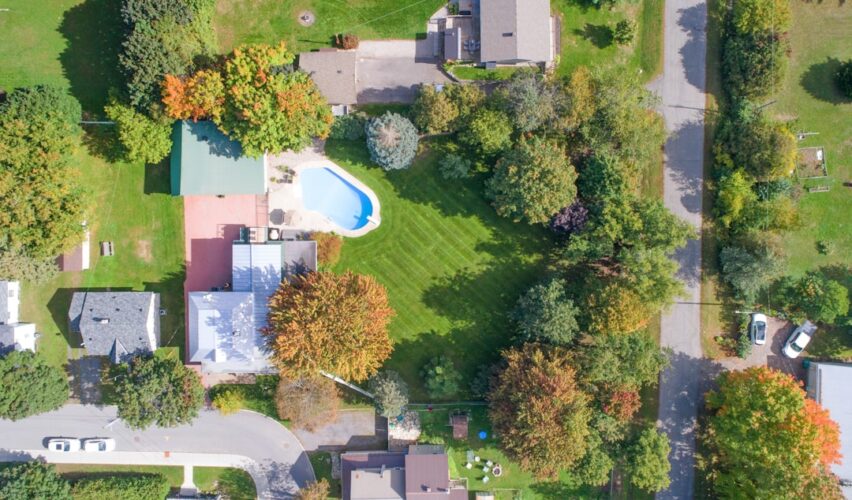
When you’re trying to sell a property, context is everything. A beautiful home might look modest from street level, but an aerial view can reveal its true grandeur – the sprawling grounds, the way it sits perfectly positioned on the lot, or how the architecture flows with the landscape. This bird’s-eye perspective helps potential buyers understand exactly what they’re getting, which is crucial when making such a major investment.
Drone real estate photography truly shines when it comes to showcasing amenities that might otherwise go unnoticed. That gorgeous pool area with its surrounding deck? The private tennis court tucked behind the trees? The expansive gardens that took years to mature? Aerial shots capture these features in all their glory, helping buyers visualize the lifestyle they could be purchasing.
Lot size becomes crystal clear from above too. Instead of trying to imagine property boundaries from a written description, buyers can see exactly how much land they’re getting and how the home sits within those boundaries. This is especially valuable for larger properties where the true scope is impossible to appreciate from the ground.

The neighborhood perspective that drones provide is absolutely invaluable. Buyers can see how close the property is to parks, schools, shopping centers, or that beautiful lake they spotted on the map. This context often matters just as much as the house itself – after all, you’re not just buying a home, you’re buying into a community and lifestyle.
There’s something powerful about the emotional impact of aerial photography. When buyers see a property from above, especially one that’s close to natural features like beaches or parks, it creates an emotional connection that static ground-level photos rarely achieve. This emotional response is what separates a listing that gets forgotten from one that gets remembered – and ultimately, visited.
In today’s crowded market, standing out from the competition is more important than ever. Properties with aerial photography are 65% more likely to generate in-person showings, which speaks volumes about their effectiveness in capturing buyer attention.
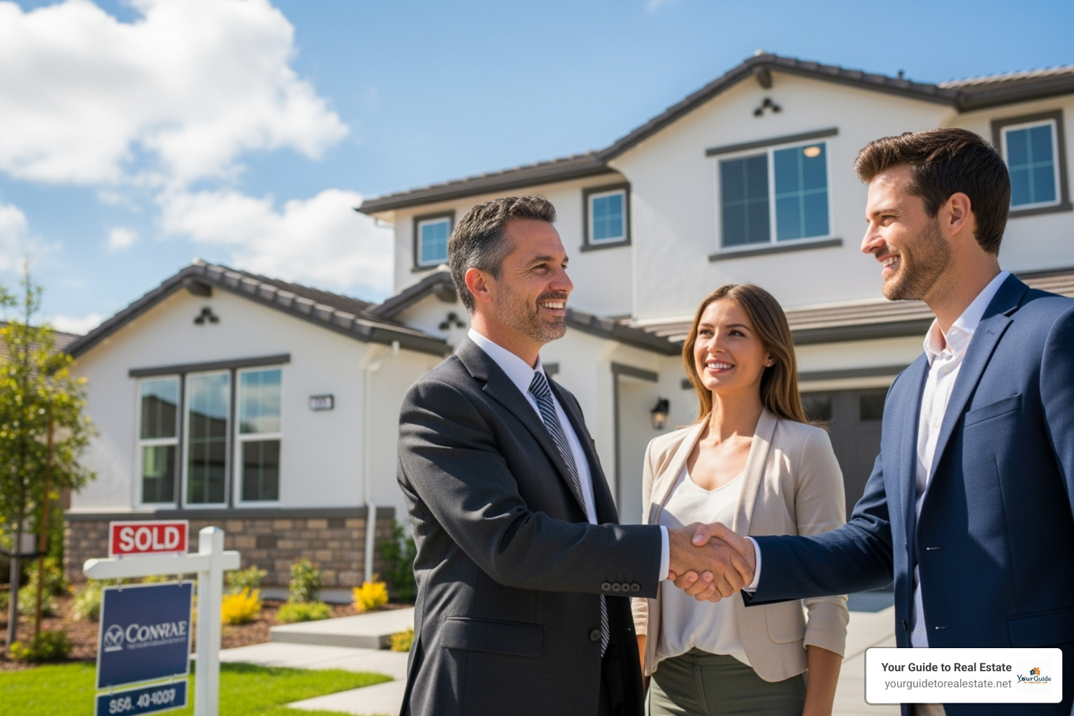
When you’re ready to work with a real estate professional, choosing someone who understands the power of modern marketing tools like drone photography can make all the difference. For tips on finding the right agent, check out our guide on How to Choose the Right Real Estate Agent: A Complete Buyer’s Guide.
The Benefits of Professional Drone Real Estate Photography
The numbers don’t lie – drone real estate photography delivers real results that translate directly into faster sales and happier sellers. Properties featuring aerial photography sell 68% faster than those without, which means less time on the market and reduced carrying costs for sellers.
But it’s not just about speed. These listings also tend to attract higher offers, with some studies showing price increases of up to 10% for homes marketed with professional aerial imagery. When you consider the relatively small investment in drone photography compared to these potential returns, it’s easy to see why smart sellers are embracing this technology.
The increased buyer interest is remarkable. As mentioned, listings with drone photos are 65% more likely to get in-person showings, which is the critical first step toward making a sale. More showings mean more opportunities to connect with the right buyer, and that’s what successful real estate marketing is all about.
It’s no surprise that 83% of home sellers prefer working with agents who use drone photography. This isn’t just about having the latest gadgets – it’s about demonstrating a commitment to using every available tool to market their property effectively.
Professional drone photography dramatically improves online listings, which is crucial since 97% of home buyers start their search online. In a sea of similar-looking ground-level photos, aerial shots make listings pop off the screen and demand attention. This improved visual appeal doesn’t just benefit individual listings – it also strengthens agent branding by positioning professionals as innovative and results-focused.
The National Association of Realtors has documented the effectiveness of drones in real estate through various studies on drone effectiveness, providing additional validation for this powerful marketing tool.
The Impact of Drone Technology on the Market
The real estate industry has experienced a dramatic change, moving away from static, ground-level photography toward dynamic, immersive visual experiences. This shift accelerated significantly during the pandemic, with 7 in 10 agents reporting that videos, virtual staging, and drone real estate photography became more important since COVID-19 changed how people shop for homes.
Virtual property exploration went from nice-to-have to absolutely essential almost overnight. Aerial views became a critical component of comprehensive virtual tours, allowing buyers to explore properties remotely while still getting a complete understanding of what they were considering.
This evolution perfectly aligns with Millennial buyer expectations. This tech-savvy generation expects high-quality visuals and instant access to comprehensive information. They want to see everything about a property before deciding whether it’s worth their time to visit in person. Drone photography delivers exactly what they’re looking for – a complete overview that helps them visualize both the property and their potential life there.
The market growth speaks for itself. The real estate drone services market is projected to reach $1.13 billion by 2029, up from $0.49 billion in 2024. That’s an impressive 18.1% compound annual growth rate, reflecting the increasing demand and adoption of aerial imagery throughout the industry.
This technological revolution is just one part of the broader changes reshaping real estate. To understand how these innovations fit into the bigger picture, explore our insights on How Technology Is Revolutionizing Real Estate: 2025 Trends to Watch.
The Legal Lowdown: Flying Drones for Real Estate Commercially
Before you launch that drone into the sky for your first real estate shoot, let’s talk about the legal side of things. Trust me, this isn’t the fun part, but it’s absolutely essential. The last thing you want is a hefty fine from the FAA or legal trouble that could shut down your drone real estate photography business before it even gets off the ground.
Here’s what many people don’t realize: there’s a big difference between flying your drone for fun on weekends and using it to make money. The moment you capture photos or videos for a real estate listing – even if you’re not directly charging for the drone service – you’re operating commercially in the eyes of the law.
The FAA (Federal Aviation Administration) sets the rules for all drone operations in the United States, and compliance isn’t optional. But federal regulations are just the beginning. Your local city or county might have additional rules about where and when you can fly. Some areas have noise ordinances, specific privacy laws, or even complete drone bans in certain zones.
Privacy concerns are particularly important in real estate photography. While you’re focused on showcasing a beautiful property, neighbors might not appreciate a drone buzzing over their backyard barbecue. Although federal law makes it a felony to shoot down a drone, property owners can still pursue legal action if they feel their privacy has been violated.
Don’t forget about liability and insurance. While the FAA doesn’t require insurance for commercial drone pilots, most real estate agencies and clients will demand proof of at least $1 million in liability coverage. Professional drone operators typically invest $450 to $750 annually in liability insurance. It might seem expensive, but it protects everyone involved if something goes wrong during a flight.
Obtaining Your FAA Part 107 Certificate
If you want to fly drones commercially, you’ll need to earn your Remote Pilot Certificate, commonly called a Part 107 certificate. Think of it as your driver’s license for the skies – it proves you understand how to operate safely and legally.
Getting certified means passing an aeronautical knowledge test that currently costs $175. Don’t worry, you don’t need to become a pilot, but you will need to understand the basics of airspace, weather patterns, airport operations, and federal regulations. The test covers everything from reading sectional charts to communicating with air traffic control.
The good news? There are plenty of study resources available online to help you prepare. Many people find the material challenging at first, but with proper preparation, most pass on their first attempt. Once you’ve earned your certificate, you’ll need to renew it every 24 months. The renewal process used to require another knowledge test, but now it’s much simpler – just complete free online training.
All drones used for commercial work must be registered with the FAA, regardless of their weight. This costs just $5 per drone and needs renewal every three years. As of March 2024, you’ll also need Remote ID capability, which means your drone broadcasts its identification and location information during flight.
For complete details on the certification process, check out the FAA’s official guide: Become a Drone Pilot and The FAA CFR Part 107 drone pilot exam.
Key Flight Rules to Follow
Even with your shiny new Part 107 certificate, you’ll need to follow specific flight rules every time you operate. These aren’t suggestions – they’re federal regulations designed to keep everyone safe.
The maximum altitude rule is straightforward: keep your drone below 400 feet above ground level. This height limit ensures separation from manned aircraft and is strictly enforced. It’s 400 feet above the ground directly below your drone, not above your takeoff point.
Visual line-of-sight (VLOS) means you must be able to see your drone with your naked eyes at all times. No binoculars, no relying solely on the camera feed. If you can’t see it, you can’t fly it safely.
Flying over people has become more flexible thanks to updated FAA rules, but it’s still restricted. Generally, you can only fly over people who are directly involved in your operation unless your drone meets specific safety classifications. The rules are complex, so always check the latest FAA Operations Over People rules before each shoot.
Night operations are now allowed under Part 107, but your drone must have anti-collision lighting visible for at least 3 statute miles. You’ll also need special authorization to fly at night in controlled airspace.
Airspace restrictions are perhaps the most complex rules to steer. You cannot fly near airports, military bases, national parks, or areas with temporary flight restrictions without proper authorization. The B4UFLY app is your best friend here – it shows you exactly where you can and cannot fly, and helps you request authorization when needed.
For flights in controlled airspace, you’ll need to use the LAANC (Low Altitude Authorization and Notification Capability) system to get permission. It sounds complicated, but most approvals are granted within minutes for routine drone real estate photography operations.
Essential Gear and Techniques for Compelling Drone Real Estate Photography
Think of drone real estate photography like cooking a gourmet meal – you need the right ingredients, proper technique, and a dash of creativity to create something truly spectacular. Having a drone is just the beginning; knowing how to use it effectively is what separates amateur snapshots from professional marketing materials that sell homes.

Choosing the right equipment goes beyond just picking the fanciest drone. We need to consider camera quality, flight stability, and features that specifically help with real estate visuals. A drone with excellent image stabilization and high-resolution capabilities will capture those crisp, professional shots that make buyers stop scrolling and start dreaming.
But here’s where many people stumble – they skip the pre-flight planning phase. Before we even power up the drone, we’re already working. This means studying satellite maps of the property, identifying potential obstacles like power lines or tall trees, and mapping out our flight paths. We’re also checking the weather forecast because high winds, rain, or even harsh midday sun can turn a promising shoot into a frustrating experience.
Timing is everything in aerial photography. The magic happens during the “golden hour” – that sweet spot shortly after sunrise or before sunset when the light is soft and warm. This natural lighting makes any property look more inviting and minimizes those harsh shadows that can hide important details. If we must shoot during midday, neutral density filters become our best friend for managing bright sunlight and glare.
The final piece of the puzzle is post-production editing. Raw footage from the drone is like a rough diamond – it has potential, but it needs polishing to truly shine. Shooting in RAW format gives us maximum flexibility to adjust colors, improve details, and remove any distracting elements. This is where good photos become great marketing tools. For more insights on capturing stunning property visuals from all angles, check out our Home Photography Tips.
Choosing the Best Drones for Real Estate
Selecting the perfect drone for drone real estate photography feels a bit like choosing a car – there are many great options, but the best choice depends on your specific needs and budget. We’ve tested countless models over the years, and certain features consistently make the difference between amateur and professional results.
Camera quality sits at the top of our priority list. Look for drones that offer at least 12 megapixels for still photos and 4K video capabilities. Higher megapixel counts, like 20MP or even 48MP, give you more flexibility for cropping and zooming without losing image quality. A 3-axis gimbal is absolutely essential – it’s what keeps your footage smooth and stable, even when there’s a gentle breeze.
Flight time matters more than you might think. Nothing kills the creative flow like having to land every 15 minutes to swap batteries. We recommend drones that offer 25-30+ minutes of flight time per battery. Trust us, you’ll want to carry multiple batteries regardless, but longer flight times mean fewer interruptions during those perfect lighting conditions.
Smart features can transform challenging shots into effortless captures. Obstacle avoidance sensors act like a safety net, especially when flying close to buildings or trees. GPS stability keeps the drone perfectly positioned for those precise shots, while intelligent flight modes like Orbit or Waypoints can create cinematic movements that would be nearly impossible to achieve manually.
Here’s how some popular drone models stack up for real estate work:
| Drone Model | Camera Quality (Stills/Video) | Flight Time (per battery) | Key Features | Price Range (Approx.) |
|---|---|---|---|---|
| DJI Mini 4 Pro | 48MP / 4K 60fps D-Log | ~34 min | Omnidirectional Obstacle Sensing, FocusTrack, Vertical Shooting | $959 – $1,159 |
| DJI Mavic Air 2 | 48MP / 4K 60fps | ~34 min | APAS 3.0 Obstacle Avoidance, FocusTrack, OcuSync 2.0 | $799 – $999 |
| DJI Phantom 4 Pro V2.0 | 20MP / 4K 60fps | ~30 min | 5-Direction Obstacle Sensing, Mechanical Shutter, Professional Optics | $1,599 – $2,000+ |
| Ruko F11 Pro | 4K UHD | ~36 min | GPS Auto Return, Brushless Motors, 5GHz FPV | $300 – $500 |
The DJI Mini 4 Pro has become a favorite among real estate professionals for good reason. It strikes an excellent balance between advanced features, image quality, and portability. For those just starting out, it offers professional capabilities without the intimidating price tag of larger, more complex systems.
Sensor size also plays a crucial role, especially when shooting during challenging lighting conditions. Larger sensors perform better in low light and capture more detail in both bright and shadowed areas of a property – something that’s particularly important when showcasing homes with deep overhangs or dense landscaping.
Essential Shots and Videography Techniques
Creating compelling drone real estate photography is like directing a mini-movie about each property. Every shot should serve a purpose and contribute to the overall story we’re telling potential buyers about their future home.
The top-down nadir view is our wide establishing shot. This bird’s-eye perspective shows the entire property layout, including the house footprint, landscaping, pool, driveway, and property boundaries. It’s incredibly valuable for buyers who want to understand exactly what they’re getting and how everything fits together.
Front elevation shots capture the home’s curb appeal from a slightly liftd angle. This isn’t just a basic front-of-house photo – we’re showcasing the architectural details, the landscaping, and how the home sits on its lot. It’s often the first impression buyers get of the property’s character and style.
Oblique angles bring drama and depth to our shots. By positioning the drone at 45-degree angles from various corners of the property, we can show multiple sides of the home while highlighting its relationship with the surrounding landscape. These shots often reveal features that straight-on photos miss entirely.
The reveal shot is pure cinematic magic. We start close to an interesting feature – maybe a beautiful tree, an ornate gate, or architectural detail – then slowly pull back to reveal the entire property. This technique creates that “wow” moment that makes viewers want to see more.
Orbit shots provide a comprehensive 360-degree view by circling the property at a consistent altitude and distance. This technique is particularly effective for showcasing how a home sits within its neighborhood context and for highlighting outdoor amenities like pools, gardens, or entertainment areas.
For those ready to push creative boundaries, fly-through shots using FPV drones can create incredibly immersive experiences. These shots might glide under pergolas, through open spaces, or around architectural features, giving viewers a unique perspective that traditional photography simply cannot achieve.
Creating a narrative with these shots transforms a collection of photos into a compelling story. We think about the buyer’s journey – what do they want to see first? How can we build excitement and emotional connection? A well-planned sequence might start with a dramatic reveal, move to detailed architectural shots, then showcase the backyard oasis, and conclude with a neighborhood context shot that shows nearby amenities.
This storytelling approach, combined with professional editing and smooth transitions, creates marketing materials that don’t just show a property – they sell a lifestyle. For insights on how these aerial visuals integrate with other cutting-edge marketing techniques, explore our guide to Virtual Real Estate Home Tours.
The Business Side: Pricing, Marketing, and Challenges
Getting into drone real estate photography is exciting, but let’s be honest – it’s not just about capturing beautiful shots. Whether you’re a real estate agent looking to level up your listings or starting a drone photography business, you need to understand the nuts and bolts of making it profitable.

Building a strong portfolio is where everything starts. When you’re just beginning, consider offering a few complimentary shoots to build your collection. This isn’t just charity work – it’s smart business. These initial projects give you real-world experience, help you refine your skills, and most importantly, provide testimonials from happy clients.
Client communication makes or breaks your success. You need to clearly explain what drone real estate photography brings to the table. Show them those statistics we talked about earlier – the 68% faster sales, the increased buyer interest. Help them understand that this isn’t just a nice-to-have; it’s a competitive advantage that can significantly impact their bottom line.
The key is positioning yourself as a partner in their success, not just someone with a fancy camera that flies. This approach to building lasting business relationships aligns perfectly with the strategies outlined in our Real Estate Business Growth guide.
Pricing Models for Drone Real Estate Photography
Pricing drone real estate photography can feel like walking a tightrope. Price too low, and you’ll struggle to make a profit. Price too high, and potential clients might look elsewhere. The sweet spot depends on several key factors that directly impact your time, effort, and expertise.
Property size and complexity play a huge role in pricing. A cozy suburban home with a small yard requires far less flight time and fewer shots than a sprawling estate with multiple buildings, pools, and extensive landscaping. Each additional feature means more planning, more shots, and more editing time.
Location matters more than you might think. Operating in busy urban areas like downtown Dallas often requires additional airspace authorizations and more complex flight planning. Rural properties might be easier to fly but could involve longer travel times. These operational differences should be reflected in your pricing.
The scope of services you provide dramatically affects cost. Are you delivering just basic aerial photos, or are you creating a comprehensive package with 4K video, twilight shots, and detailed property boundary overlays? Each additional service adds value and justifies higher pricing.
Your experience and reputation as a drone pilot also influence what you can charge. Clients pay premium rates for photographers who consistently deliver stunning results and handle complex situations professionally. As you build your portfolio and client testimonials, your rates should reflect that expertise.
Turnaround time expectations can significantly impact pricing. If a client needs photos delivered within 24 hours for a hot listing, that rush service commands a premium. Standard delivery might be 3-5 business days, while expedited service costs extra.
Most successful drone photographers use flat rate packages as their primary pricing model. A basic photo package might start around $150-$400, including 10-15 edited aerial photos. Comprehensive packages with both photos and professional video typically range from $500-$1,000 or more, depending on the property and market.
Some photographers prefer hourly rates, especially for complex properties that are difficult to estimate upfront. These rates typically range from $100-$300 per hour, depending on experience and market demand.
Add-on services provide excellent opportunities to increase revenue while delivering more value. Twilight photography, 3D property mapping, or custom video editing can each add $100-$300 to your base package.
Understanding how these visual assets impact property values helps justify your pricing to clients. Our guide to Real Estate Valuation explores how professional photography influences buyer perceptions and offers.
Marketing Your Listings with Drone Visuals
Once you’ve captured those breathtaking aerial shots, the real magic happens in how you use them to market properties. Drone real estate photography gives you incredibly versatile content that performs exceptionally well across multiple channels.
Social media becomes your best friend when you have stunning aerial content. Instagram and Facebook users can’t scroll past a beautiful aerial video without stopping to watch. These visuals generate significantly more engagement than standard ground-level photos, expanding your reach and attracting potential buyers who might never have seen the listing otherwise.
Single property websites transform from basic information pages into immersive experiences when you feature aerial photography prominently. A hero video showing the property from above immediately communicates luxury and professionalism, making visitors more likely to explore further and schedule showings.
Email marketing campaigns see dramatic improvement in open rates and click-throughs when they feature compelling aerial imagery. A striking drone photo as your email header or a link to an aerial tour video can turn a routine newsletter into must-see content.
Digital advertising becomes infinitely more effective with drone visuals. Online ads featuring aerial photography stand out in crowded feeds and search results. These eye-catching visuals attract more qualified leads because viewers are already impressed by the property’s presentation before they even click.
MLS listings benefit enormously from aerial photography, though you’ll need to check local MLS rules about image requirements and video links. Properties with aerial photos consistently attract more views and generate more showing requests than those with only ground-level photography.
The key is using your drone real estate photography strategically across all these channels to create a cohesive, impressive marketing campaign. Each platform reinforces the others, building momentum and keeping your listings top-of-mind for potential buyers. For more detailed strategies on maximizing your marketing impact, explore our Marketing Fundamentals guide.
Common Challenges and How to Overcome Them
Let’s be real – drone real estate photography isn’t always smooth sailing. Every experienced pilot has faced challenges that can disrupt shoots, frustrate clients, or even impact safety. The good news is that most problems are predictable and manageable with the right preparation.
Weather conditions top every drone pilot’s list of challenges. Wind speeds above 20 mph make flying dangerous and create shaky footage. Rain, snow, and fog obviously ground your drone, but even overcast skies can create flat, uninspiring images. The solution is building flexibility into your schedule and setting clear expectations with clients about weather-related rescheduling. Sometimes you can turn challenging conditions into opportunities – early morning fog can create dramatic, moody shots for certain properties.
Navigating complex regulations continues to challenge even experienced pilots as rules evolve. FAA regulations, local ordinances, and temporary flight restrictions can change quickly, potentially grounding your planned shoot. Stay ahead of this by using apps like B4UFLY before every flight, maintaining current LAANC authorizations, and keeping your Part 107 certificate updated. Building buffer time into your schedule helps accommodate last-minute regulatory problems.
Battery life limitations can frustrate photographers working with larger properties or complex shot lists. Most consumer drones offer 25-35 minutes of flight time per battery, which disappears quickly when you’re capturing multiple angles and video sequences. Always carry at least three fully charged batteries and plan your shots efficiently to maximize each flight. Portable charging solutions can extend your shooting capabilities for all-day projects.
Privacy concerns from neighbors occasionally arise, even when you’re flying legally over the property you’re hired to photograph. Some neighbors worry about cameras near their homes, regardless of your professional intentions. Address this proactively by informing nearby residents about your planned shoot when possible. Avoid pointing cameras directly into neighboring homes and maintain respectful distances from property lines.
Market competition intensifies as more people enter the drone photography space. The relatively low barrier to entry means you’ll face competition from hobbyists offering rock-bottom prices. Combat this by focusing on superior quality, exceptional customer service, and comprehensive packages that go beyond basic aerial photos. Building a strong brand identity and showcasing your unique style helps justify premium pricing and attracts clients who value professionalism over bargain rates.
The most successful drone real estate photography businesses anticipate these challenges and develop systems to handle them smoothly. Your ability to steer problems professionally often impresses clients more than perfect conditions ever could.
Frequently Asked Questions about Drone Real Estate Photography
We get a lot of questions about drone real estate photography from both agents and homeowners who are curious about this game-changing technology. Let’s explore the most common concerns we hear and give you the straight answers you need.
Do I need a license to fly a drone for real estate photography?
Yes, you absolutely do need proper certification if you’re using a drone for any commercial purpose. This includes capturing photos or videos for real estate listings, even if you’re not directly charging clients for the drone service itself. The moment money changes hands – whether directly or indirectly – your flight becomes a commercial operation in the eyes of the FAA.
To fly legally for business, you’ll need an FAA Part 107 Remote Pilot Certificate. This involves passing a knowledge test that covers safety regulations, airspace rules, weather considerations, and proper operating procedures. The test currently costs $175 and covers everything from reading sectional charts to understanding how weather affects flight safety.
Don’t think you can skip this step. Flying commercially without proper certification can result in hefty fines and serious legal penalties. The FAA takes this seriously, and getting caught isn’t worth the risk to your business or reputation.
How much does drone real estate photography cost?
The cost of drone real estate photography varies quite a bit, and honestly, that’s because every property and photographer brings something different to the table. We’ve seen prices range from around $150 for basic aerial photos to well over $500 for comprehensive packages that include cinematic videos and advanced editing.
Several factors influence what you’ll pay. Property size and complexity play a huge role – shooting a cozy suburban home is very different from capturing a sprawling estate with multiple outbuildings. Location matters too – urban areas often have different pricing structures than rural settings, partly due to airspace complexities and market demand.
The services included make a big difference in pricing. A basic package might give you 5-10 stunning aerial photos for $150-$400. But if you want a cinematic video, twilight shots, or extensive editing work, you’re looking at $500 to $1,000 or more. Photographer experience also affects cost – seasoned pilots with top-notch equipment and proven track records naturally command higher fees.
Turnaround time can bump up the price too. Need those photos delivered in 24 hours instead of the usual 3-5 days? Expect to pay extra for that rush service. You’re not just paying for the flight time – there’s significant work that goes into planning, editing, and delivering professional-quality results.
Can drones be flown in any weather?
Definitely not, and this is one of the biggest misconceptions we encounter. Drones have real limitations when it comes to weather conditions, and pushing these limits can be both dangerous and expensive.
High winds are probably the biggest concern. Most consumer drones start struggling once winds exceed 15-20 mph, and flying in gusty conditions can result in shaky footage, crashed drones, or worse – injury to people or property damage. Rain and snow are absolute no-gos for most drones, as moisture can damage sensitive electronics and create serious safety hazards.
Even dense fog can be problematic, not just for image quality but because it reduces visibility and can interfere with the drone’s sensors. We always check weather forecasts carefully before any shoot, and we’re prepared to reschedule if conditions aren’t ideal.
Here’s the thing – a professional drone real estate photography service will prioritize safety and quality over keeping to a tight schedule. It might be disappointing to reschedule a shoot, but it’s much better than ending up with poor-quality images or, worse, a damaged drone and potential liability issues. Sometimes we can work around weather challenges – certain moody conditions might actually improve some property types – but safety always comes first.
The best drone photographers build weather contingencies into their scheduling and communicate clearly with clients about potential delays. It’s all part of delivering professional, high-quality results that truly showcase your property.
Conclusion
What an incredible journey we’ve taken together through drone real estate photography! From those breathtaking aerial shots that make buyers stop scrolling to the legal requirements that keep us flying safely, we’ve covered everything you need to know about this game-changing technology.
The numbers don’t lie – properties with drone photography sell 68% faster and attract 65% more showings. That’s not just a nice-to-have anymore; that’s a competitive advantage that can make or break a listing in today’s market. When 83% of sellers prefer agents who use drone photography, it’s clear that this technology has moved from novelty to necessity.
We’ve walked through the essential steps together: getting your FAA Part 107 certification (yes, it’s required!), choosing the right equipment for your budget, mastering those must-have shots like the dramatic reveal and the comprehensive orbit, and understanding how to price your services competitively. There are challenges – weather delays, battery limitations, and the occasional concerned neighbor – but with proper planning and a professional approach, these problems become manageable stepping stones to success.
The future of real estate marketing is unfolding before our eyes, and it’s beautifully aerial. Drone real estate photography isn’t just about taking pictures from above; it’s about telling the complete story of a property. It’s showing that stunning pool from the perfect angle, capturing how the home nestles into its landscape, and giving buyers that emotional connection that ground-level photos simply can’t provide.
At Your Guide to Real Estate, we believe in giving you the proven frameworks and stress-free guidance you need to thrive in this exciting, changing market. Whether you’re a seasoned agent looking to add aerial photography to your toolkit or a newcomer ready to accept cutting-edge marketing strategies, the sky truly is the limit.
Ready to take your real estate business to new heights? Don’t stop here – explore our Virtual Real Estate Brokerage guide to find even more innovative strategies that will set you apart from the competition.


")